|
 
|
| --click on the thumbnail to view the larger image -- |
|
 |
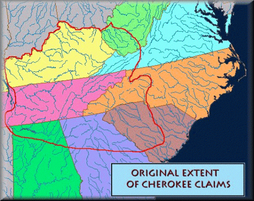
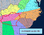
The boundaries of the Cherokee Country prior to the European invasion. |
|
 |
The boundaries of the Cherokee Country at the end of the Revolutionary
War. |
|
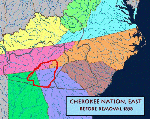 |
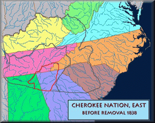
The boundaries of the Cherokee Country in the east prior to the removal.
It should be noted that before the removal, much of the Nation was overrun
by whites who had taken over Vann's house at Springplace, Major Ridge's
house (Rome GA), and Chief John Ross's house (Rossville GA). The Cherokee
council had been meeting at Red Clay on the Tennesse border because the
State of Georgia was using the Georgia Militia to prevent them from meeting
at the capital at New Echota. Lands in Georgia had already been granted
to white lottery winners in the Georgia Land and Gold Lotteries. |
|
 |
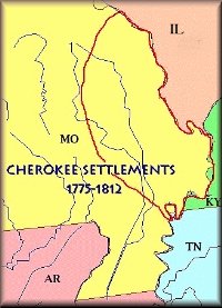
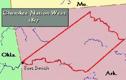
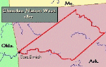
A large group of Cherokees moved west of the Mississippi (Spanish territory)
with the permission of the Spanish govenor in New Orleans. Groups continued
to move west to escape the flood of white settlers onto Cherokee land in
NC, GA, and TN. |
|
 |
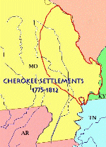
Cherokees who had been moving west since before 1800 were joined by
an ongoing migration from the original Nation in the East. A large number
of Cherokees had moved into the Arkansas Territory and settled on either
side of the Arkansas River between present Ft Smith and Russellville AR.
Most of the Cherokees already living around the "bootheel" of Missouri
had moved to this area also. The boundaries were established by treaty
with the US in 1817. Most the the settlements were along either side of
the Arkansas River (the southern boundary) and the White River (the northern
boundary). The Arkansas Cherokee (aka Western Cherokee or Old Settlers)
were forced to move again in 1828 to what is now Northeastern Oklahoma. |
|
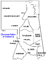 |
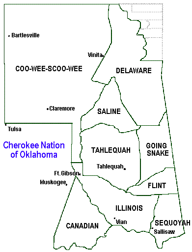
The Cherokee Nation of Oklahoma showing boundaries and districts at
the time of Oklahoma statehood - 1907. |
|
 |
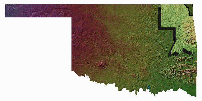
The Cherokee Nation of Oklahoma |
|
Links to Cherokee Historical Maps
-
From
the Rare Map Collection at the University of Georgia. This collection
includes maps showing the location of the Cherokee Country 1732-1838.
|
|
 Copyright © Ken Martin, 1996
|